
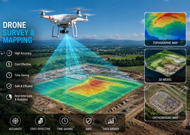
Drone Survey & Mapping

Drone Survey & Mapping
Advanced Drone Survey & Mapping Solutions for Accurate Geospatial Intelligence
Tripathi Aerospace offers professional Drone Survey & Mapping Services using advanced UAV technology to deliver fast, accurate, and cost-effective geospatial data for infrastructure development, engineering, construction, mining, agriculture, government, and industrial projects. Our modern drone surveying solutions significantly reduce project timelines while providing highly accurate aerial data that supports better planning, design, monitoring, and decision-making.
Traditional land surveying methods often require extensive manpower, longer project durations, and significant operational costs, especially in difficult terrains or large project sites. Our drone-based surveying solutions overcome these challenges by utilizing high-resolution aerial imaging, advanced photogrammetry, GPS technology, and intelligent data processing to generate precise maps, orthomosaic images, digital elevation models (DEM), digital surface models (DSM), contour maps, 3D terrain models, and volumetric calculations.
Tripathi Aerospace operates advanced UAV platforms equipped with professional mapping cameras, RTK/PPK positioning systems, intelligent flight planning software, and high-precision navigation technology. Our experienced survey professionals ensure every mission is executed with maximum accuracy, safety, and efficiency while complying with industry standards.
Whether the project involves highways, railways, mining areas, transmission corridors, industrial facilities, smart cities, agricultural land, pipelines, or government infrastructure, our drone survey solutions provide reliable geospatial information that supports every stage of project development.
Service Overview
Our Drone Survey & Mapping Division delivers end-to-end aerial surveying solutions for engineering consultants, EPC companies, infrastructure developers, mining organizations, government departments, and private enterprises.
We combine advanced UAV technology with professional data processing software to produce highly accurate deliverables suitable for engineering design, planning, project monitoring, and asset management.
Our Survey & Mapping Services
- Aerial Topographic Survey
- Drone Photogrammetry
- Orthomosaic Mapping
- Digital Elevation Model (DEM)
- Digital Surface Model (DSM)
- Contour Mapping
- Corridor Survey
- Route Alignment Survey
- Land Survey
- Construction Progress Monitoring
- Stockpile Volume Calculation
- Cut & Fill Analysis
- Mine Survey
- GIS Data Collection
- Asset Mapping
- Infrastructure Inspection
- Plantation Survey
- Agricultural Land Mapping
Key Features
- High-Resolution Aerial Imaging
- RTK/PPK Precision Survey
- Autonomous Flight Planning
- Fast Data Acquisition
- Accurate Geospatial Data
- High-Capacity UAV Platforms
- Professional Survey Equipment
- Advanced GIS Integration
- 3D Terrain Modeling
- Engineering-Grade Deliverables
- Large Area Coverage
- Digital Mapping Solutions
- Safe Operations in Difficult Terrain
- Reduced Project Time
- Cost-Effective Survey Solutions
Our Survey Process
1. Project Consultation
Our survey specialists understand project objectives, required deliverables, site conditions, and technical specifications before planning drone operations.
2. Mission Planning
Using specialized flight planning software, optimized UAV flight paths are generated to ensure complete site coverage and maximum survey accuracy.
3. Drone Data Acquisition
Our professional UAV systems capture high-resolution aerial images using RTK-enabled positioning and intelligent autonomous flight technology.
4. Data Processing
Captured aerial imagery is processed using advanced photogrammetry software to generate engineering-grade mapping outputs and geospatial datasets.
5. Quality Verification
Survey data undergoes rigorous quality checks to ensure accuracy, completeness, and compliance with project specifications.
6. Final Deliverables
Clients receive professionally processed maps, reports, GIS files, CAD-compatible outputs, orthomosaics, terrain models, and volumetric calculations ready for engineering applications.
Key Benefits
- Up to 80% Faster Than Traditional Survey Methods
- High Survey Accuracy
- Reduced Field Manpower
- Lower Project Costs
- Improved Worker Safety
- Large Area Coverage
- Quick Project Turnaround
- Reliable Engineering Data
- Digital Project Documentation
- Better Decision-Making Through Accurate Mapping
Applications
Infrastructure Development
Survey highways, expressways, bridges, railways, metro corridors, airports, industrial parks, and smart city projects with high accuracy.
Construction Monitoring
Track project progress, monitor construction activities, verify completed work, and generate periodic progress reports.
Mining & Quarry Survey
Perform stockpile measurements, pit mapping, volumetric calculations, excavation monitoring, and mine planning with precise aerial data.
Oil & Gas Projects
Monitor pipelines, refineries, storage facilities, and energy infrastructure while improving operational safety and inspection efficiency.
Agriculture & Plantation
Map agricultural land, plantation areas, irrigation systems, crop health zones, and precision farming projects.
Government Projects
Support urban planning, land management, disaster assessment, public infrastructure development, and environmental monitoring.
Deliverables We Provide
- Orthomosaic Maps
- Digital Elevation Models (DEM)
- Digital Surface Models (DSM)
- Contour Maps
- 3D Terrain Models
- Point Cloud Data
- GIS Compatible Files
- CAD Drawings
- Stockpile Volume Reports
- Cut & Fill Reports
- Site Progress Reports
- Survey Documentation
- Georeferenced Images
- Engineering Mapping Outputs
Industries We Serve
- Infrastructure Development
- Construction Companies
- Mining Industry
- Oil & Gas
- Power & Energy
- Railways
- Highways
- Agriculture
- Smart Cities
- Government Departments
- Real Estate Developers
- Engineering Consultants
Why Choose Tripathi Aerospace?
Tripathi Aerospace combines advanced UAV technology, professional survey expertise, and engineering-grade data processing to deliver accurate geospatial intelligence for projects of every scale.
Our Advantages
- Professional Drone Survey Team
- Advanced RTK Survey Equipment
- High-Resolution Mapping Cameras
- Engineering-Grade Accuracy
- Fast Project Delivery
- PAN India Survey Operations
- Experienced GIS Specialists
- Advanced Photogrammetry Software
- Customized Survey Solutions
- Complete Technical Support